Call us FREE 0808 2394 989
Opening Hours - Office open, we'll close at 8:00pm
Call us FREE 0808 2394 989
Opening Hours - Office open, we'll close at 8:00pm
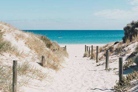
Welcome to Fremantle, a vibrant port city steeped in history and culture, nestled along the shores of the Indian Ocean just south of Perth, Western Australia.
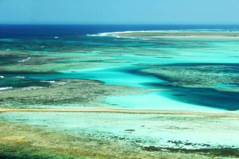
Three island groups make up the Houtman Abrolhos Islands. The Wallabi, Easter and Pelsaert groups stretch across 100 kilometers from north to south with a total of 122 islands. Named Houtman after the Dutch captain who first described them in 1619, the Portuguese word “Abrolhos” refers to the reefs and dangers they posed to unsuspecting seafarers –sometimes taken to mean “open your eyes”. The Houtman Abrolhos are known for cray fishing and pearling activities, as well as for their bird and marine life. The islands and their surrounding reef communities form one of Western Australia’s unique marine areas of tropical and temperate sea life.

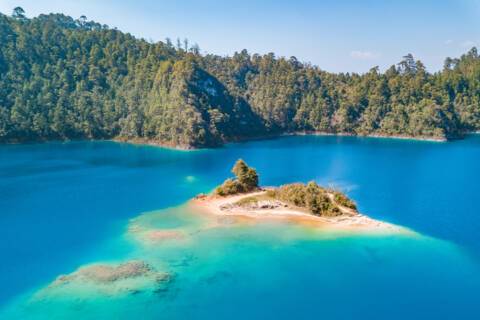

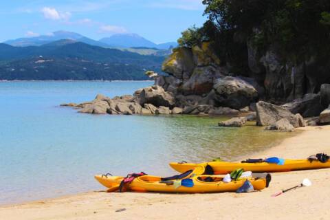
Adele Island is an island located in the Indian Ocean approximately 104 kilometres North of Ardyaloon off the Kimberley coast in Western Australia
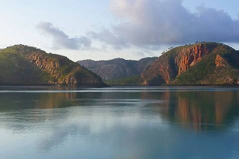
Nestled off the rugged coastline of Western Australia, the Buccaneer Archipelago stands as a rugged and untamed marine paradise.
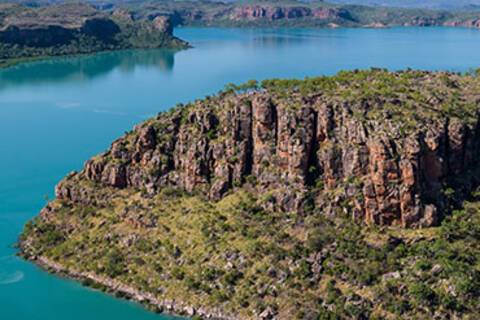
Welcome to the Hunter River, a majestic waterway winding through the heart of New South Wales, Australia.
Ashmore Reef, a remote and pristine marine sanctuary nestled in the Indian Ocean, beckons with its unparalleled biodiversity and untouched beauty.


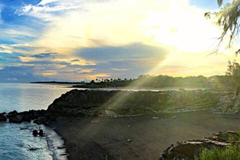
Nestled on the northern coastline of Australia, Darwin stands as a vibrant gateway to the country's untamed wilderness and a testament to resilience.


Only about 30 kilometers (19 miles) from the Indonesian border, Vanimo is the capital of the Sandaun (or Sundown) Province. It is one of only two towns in this remote region of Papua New Guinea. Although the Sepik River originates in the province, it bypasses Vanimo far to the south. The Sandaun Province is relatively undeveloped, but Vanimo has lovely beaches and some picturesque villages in the vicinity. The interior is covered in rainforest and logging is an important activity putting to use Vanimo’s port and protected bay.
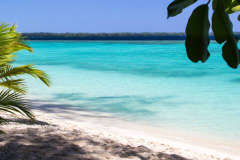
Ali Island is one of the four islands located close to Aitape, off the northern coast of Papua New Guinea. The eastern shore of Ali Island has a beautiful white sandy beach and offers swimming and snorkeling. The five villages on the island connect via well-maintained trails that lead to the school and Catholic church closer to the northern end of the island.
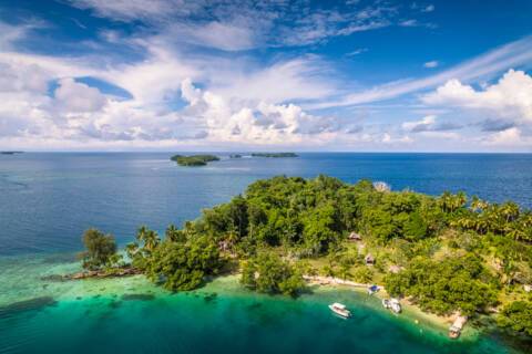
The eastern half of the island of New Guinea - second largest in the world - was divided between Germany (north) and the UK (south) in 1885. The latter area was transferred to Australia in 1902, which occupied the northern portion during World War I and continued to administer the combined areas until independence in 1975. A nine-year secessionist revolt on the island of Bougainville ended in 1997 after claiming some 20,000 lives.

The volcanic island of Garove is part of the Witu Islands and once had a 5-kilometer-wide (3.1 miles) caldera. The island was historically used to produce copra and cocoa, and in fact, still is today. Most of the villages are located around the exterior of the volcano. Steep cliffs explain why there is only one area settled on the inside. A promontory at the entrance’s southwestern corner is taken up by the school and the catholic church of the village of Widu, the only village inside the caldera.
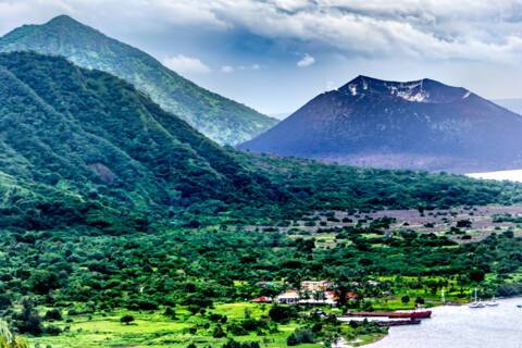
If surreal and unique experiences are your thing, then the Papua New Guinean town of Rabaul should tick your travel boxes. Found on the north eastern tip of New Britain Island (the largest island off mainland PNG) Rabaul, the former provincial capital, has quite a remarkable location. The town is inside the flooded caldera of a giant volcano and several sub-vents are still quite active today! The lively city was almost entirely devastated by Mount Tavurvur in 1994, covering the city in ashfall, but thankfully costing no lives. View less Since then, thanks to Rabaul’s deep-water port, commerce has been on the up, and a few shops and hotels have managed to find an audience. However, Rabaul’s remote location together with the volcano still being one of the most active and dangerous in Papua New Guinea means tourism in not rife. Rabaul has an impressive WWII history which includes a 300-mile network of tunnels dug by Japanese POW designed to conceal munitions and stores. After the Pearl Harbour bombings, the Japanese used Rabaul as their South Pacific base for the last four years of WWII, and by 1943 there were about 110,000 Japanese troops based in Rabaul. Post war, the island was returned to Australia, before it was granted independence in 1975. It should be noted that patience is a virtue here. However, that is not all bad. The slow pace of transportation allows travellers to marvels at the quite astonishing landscape. Divers will also be richly rewarded – the marine life of the island is extraordinary.

Kennedy Island is a small uninhabited island in the Solomon Islands that was named after John F. Kennedy, following an incident involving Kennedy during his World War II naval career. Kennedy Island lies 15 minutes by boat from Gizo, the provincial capital of the Solomon Islands' Western Province.
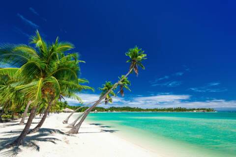
Port Mary is the name of the bay adjacent to Ghupuna, the main village in Santa Ana. A bright white sand beach with huge shade-giving trees runs along the shoreline in front of the tidy village. The houses here are made with local materials and most are built on stilts. Islanders generally welcome visitors with traditional songs and dances performed by members of the three different villages on Santa Ana. Some local people will also set up stands offering souvenirs for purchase. View less The Solomons are best known for strings of traditional shell money and elegant carvings based on local stories and legends.


Unlike Espiritu Santo with its raised coral reefs and white sand, Ambrym is a volcanically active island with dark sand beaches. Ambrym is known as the island of magic and is the source of five local languages that all evolved on Ambrym. This handful of languages contributes to the well over 100 languages of Vanuatu. Some of Ambrym’s magic takes place in the lush greenery of the local community of Ranon. Here the people perform a very special and traditional ‘Rom’ dance. Participants prepare their masks and costumes in secrecy and the dance is reserved for special occasions.

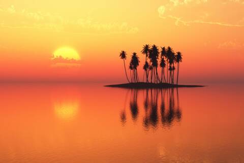
Lautoka is often described as the sugar city. Sugar cane is the major industry of Fiji and Lautoka is its main base. Here are the industries' headquarters, the largest sugar mill, modern loading facilities and a large wharf. It features 70 miles of roads, almost all paved, a wonderful botanical garden and royal palm trees decorating the city's main street, Vitogo Parade. The municipal market is another attraction from both outside and inside. Fiji typifies the image of paradise. The people here live as they have done for centuries, retaining their ancient traditions and simple and carefree lifestyle supported by the harvest of a generous land and bountiful sea.
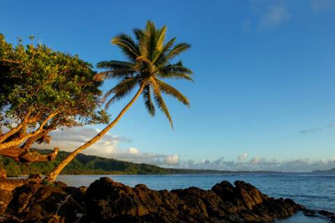
Somosomo is the largest village on Taveuni, which in turn is Fiji’s third largest island. The village has had and still has political importance as it is the headquarters for Taveuni’s highest chief, the Tui Cakau, and Fiji’s Great Council of Chiefs met in Somosomo until 2012. Somosomo and Naqara, its immediate neighboring village with a predominantly Indo-Fijian population, are the commercial center for Taveuni. View less Slightly west of Somosomo is the 180th meridian and a sign indicating the International Dateline (which has been moved east of Tonga by now) is about 2 miles to the southwest. Somosomo is also famous for the amount of soft coral in the Somosomo Strait, just west of Somosomo and Taveuni. The reefs along the Somosomo Strait are considered among the best in the South Pacific as tidal currents and constant year–round water temperature create the ideal environment for some 390 species of hard and soft corals and over 1500 species of fish. Other attractions near Somosomo are the Bouma National Park with its waterfalls and Lake Tangimaucia.

The cobia is a species of carangiform marine fish, the only representative of the genus Rachycentron and the family Rachycentridae. Other common names include black kingfish, black salmon, ling, lemonfish, crabeater, prodigal son and black bonito.
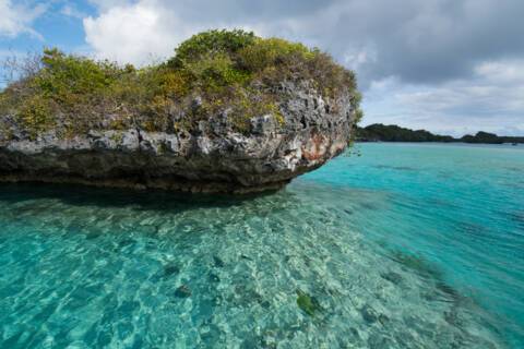
As part of the Southern Lau Group, Fulanga is one of Fiji’s easternmost islands. Fulanga has a large central lagoon with a 50-meter wide pass to the ocean on its northeastern side. The crescent-shaped raised limestone island is famous for its numerous islands, mushroom-shaped islets and many sandy beaches in the calm lagoon. Some 400 residents live in three small villages. The two villages of Muana-i-rai and Muana-i-cake are quite close together on the southern exterior side with a very narrow passage allowing access to the ocean, while Naividamu, the third village, is on the interior, i.e. lagoon side. Muana-i-cake is the main village and hosts the kindergarten and primary school, a post office and first aid station. Old-style houses made of corrugated iron are predominant with limited solar power for the odd refrigerator and television set. Although many islanders have left Fulanga to look for work in Suva, traditional crafts are still practiced by men and women. The weavers and carvers producing pandanus mats and wooden bowls for kava ceremonies are not only valued on Fulanga. Their products can leave on the monthly supply vessel and is highly sought after in Suva.
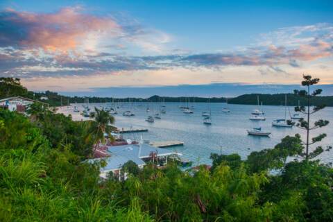
With a population of 6,000, Neiafu is the capital of the Vava’u Group and the second largest municipality in the Polynesian nation of Tonga (a 169-island archipelago in the South Pacific). The city is situated next to a deep- water harbor (Port of Refuge) on the south coast of Vava’u, the main island of the Vava’u archipelago in northern Tonga. The waters of this region are known for their clarity and beauty, and the area attracts many humpback whales between June and November. View less A popular destination in Neiafu is the ‘Ene’io Botanical Garden, a bird sanctuary that promotes the survival of exotic and native bird species as well as supports and conserves a diverse array of plant life.
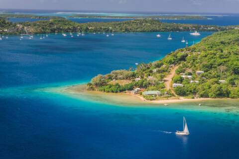
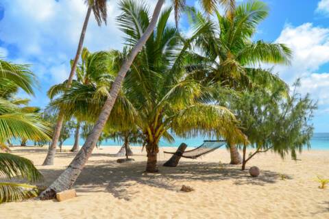


Spread over 850,000 square miles of the South Pacific Ocean, these beautiful islands and atolls were formed by volcanic activity.

Spread over 850,000 square miles of the South Pacific Ocean, these beautiful islands and atolls were formed by volcanic activity.

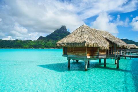
Bora Bora appears to be of another world, with pretty sand-edged motu (islets) and rainforest-covered ridges, while its fabulous coral reef is a joy to explore.
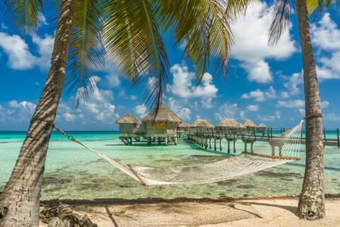
Tikehau or Porutu-kai is a coral atoll in the Palliser Islands group, part of the Tuamotu Archipelago in French Polynesia. It is included in the commune of Rangiroa.
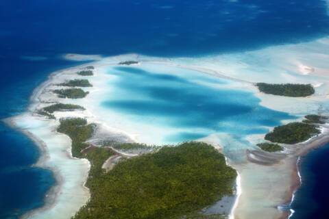
Rangiroa, meaning ‘Vast Sky’ in Puamotu, is the largest atoll in the Tuamotu Archipelago and one of the largest in the world. Surrounded by two legendary bodies of water, Moana-tea (Peaceful Ocean) and Moana-uri (Wild Ocean), the atoll consists of about 250 islets and sandbars, with approximately 100 narrow passages in the fringing reef. The lagoon covers 618 square miles (1,600 square km), large enough that it has its own horizon.
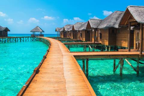
Explore the breathtaking beauty of Tahiti with its vast mountains, white sandy beaches, turquoise ocean and glittering coral reefs.
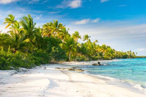
Fakarava is oblong shaped and has an almost continuous string of reef and motu stretching for 40 km (25 mi) on its eastern edge. It's the second largest of the Tuamotu atolls, located 450 km (280 mi) northeast of Tahiti, and 120 km (75 mi) southeast of Rangiroa. It's renowned for the drift diving in its two passes—Garuae (also spelled Ngarue) in the north near the main town of Rotoava (and the airport) and Tamakohua Pass, 48 km (30 mi) across the lagoon in the south. The tiny village of Tetamanu, situated by the southern pass, was once the capital of the Tuamotus and houses the first church built in the archipelago in 1874. In 2006 the entire atoll was deemed an UNESCO biosphere reserve; to preserve the lagoon no overwater bungalows have been built in it. Fakarava was "discovered" by Russian explorer Fabian Gottlieb Von Bellingshausen in 1820; some 20 years later missionaries arrived, in the guise of fanatical Catholic priest Honore Laval, and began building churches.

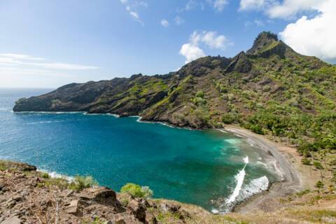
The largest of the southern islands, Hiva Oa, the master pillar or finial post of the ‘Great House’ - which represents the Marquesan archipelago in the local mythology - has always been the rival of Nuku Hiva. The island is shaped like a seahorse and has a mountain range running southwest to northeast whose main peaks, Mt. Temetiu and Mt. Feani form a real wall around Atuona. Atuona, a peaceful little port at the head of the Taaoa Bay, also known as Traitors Bay, has emerged from obscurity due to having had the privilege of being the last resting place of Paul Gauguin and of the singer Jacques Brel. The tombs of these famous personalities are on the side of the Calvary cemetery looking out across the bay and are places of great pilgrimage. In the village, the Gauguin Museum displays items related to the painter's stay there at the beginning of the century and has copies of his works.
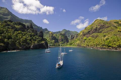
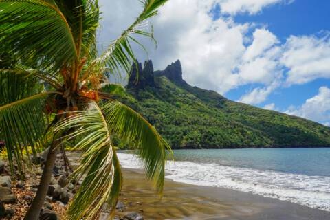
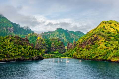

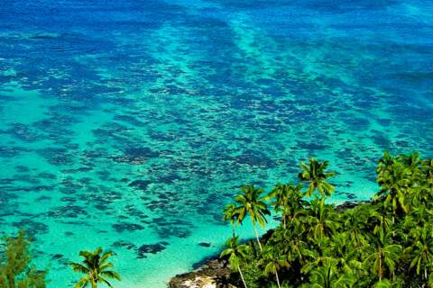
In the Gambier Islands of French Polynesia, Mangareva is the largest island with a population of over 1,200 people. Most live in Rikitea, the largest village on the island. A high central ridge runs the length of Mangareva peaking with Mt. Duff, which rises over 440 meters from the sea on the island's south coast. The island has a large lagoon sprinkled with coral reefs whose tropical fish and the black-lip oysters have helped islanders survive much more successfully than on other nearby islands. View less Small ships are able to enter the lagoon of Mangareva. Ashore visitors can walk through the town, see the remains of the massive stone and coral buildings dating back to the 19th century or climb up Mt. Duff. The highlights in town include the cathedral with its mother-of-pearl shell altar and objects designed and built in the 1830s and 1840s and partially restored by the students of Rikitea’s school just a few years ago.
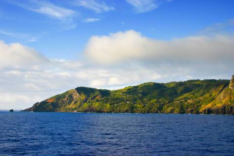
Home to the original mutineers of the Bounty, Adamstown’s is today the capital of all four Pitcairn Islands. The islands – the last British Overseas Territory in the Pacific – include the namesake Pitcairn Island itself, plus the uninhabited Oeno, Henderson and Ducie. Pitcairn is the archipelago’s only inhabited island, with the population of just 50 centred in Adamstown. It is no surprise that the nine mutineers along with six Tahitian men, 12 Tahitian women and one child stopped on Pitcairn in 1790; with its sloped and varied landscape, lush tropical promise and equidistant location between Peru and New Zealand, Pitcairn would have seemed an ideal hiding spot for the mutineers to settle. The ship was burnt to avoid detection (the ballast stone remains of the wreck in Bounty Bay). However, the ideal bucolic life that mutineer leader Fletcher Christian had envisaged was not to be. Poor treatment of the Tahitian men led to alcoholism, chaos and carnage and by 1800 only John Adams – who had recently discovered Christianity – remained. Adams taught the women and children to read and write from the bible. The capital is named after him. Not only had the island been misplaced on early maps of the region, but it can also be very difficult to come ashore as large breakers tend to build up just in front of the small harbour of Bounty Bay. The local museum houses the HMS Bounty Bible, the same bible that Adams taught the women and children to read and write from in the early 19th century.

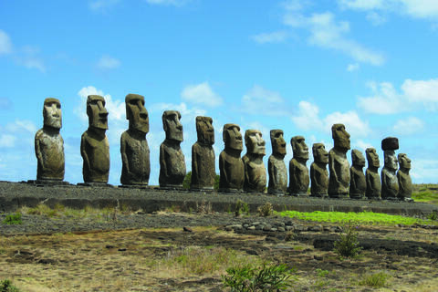
Over 1,000 miles away from its nearest inhabited neighbour, remote Easter Island is a unique Chilean treasure in the South Pacific.

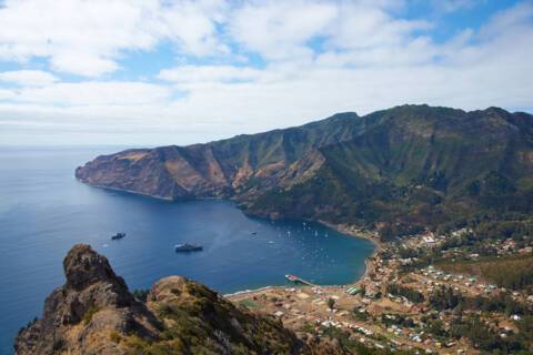
Think of Daniel Defoe’s classic novel Robinson Crusoe and you will be picturing an intrepid castaway, marooned on a paradisiacal island. That image might be ideal for movie lovers, but the actual inspiration for Robinson Crusoe was a salty Scottish seadog who went by the name of Alexander Selkirk. Selkirk was marooned in Chile’s Juan Fernandez archipelago for four years and four months, rescued by a British private warship. Despite Selkirk’s slightly chequered past, he was greeted as a celebrity upon his return to England. His adventures were given a gloss and immortalised in the much loved 18th century classic. Alejandro Selkirk Island is located 165 kilometres west of the other islands in the archipelago, for a surface area of just under 50 m2. The island was renamed from its Spanish name Isla Más Afuera in 1966 by the Chilean government in homage to the sailor. The topography is very different form the Caribbean dream that Defoe writes about, think dense woodland, rugged coast and peaks, shrouded (more often than not) in cloud. Sandy beaches can be found to the north of the island. Throughout much of its history, the island has been uninhabited, although there is a former penal settlement on the middle of the east coast, which operated from 1909 to 1930. During the summer months, Selkirk welcomes a small community of lobster fishermen and their families who come from Robinson Crusoe. As part of the Chilean National Park, it also holds the UNESCO World Biosphere Reserve title.
The friendly English-speaking population offers a unique blend of African, Spanish, Paya Indian and British cultures. British and Spanish settlers invaded the Paya as their respective countries fought over possession of Roatan in the 16th century. Soon after, pirates numbering nearly 5,000, including Henry Morgan, claimed Roatan as their stronghold. During the height of the slave trade, Roatan became a dumping ground for rebellious slaves that the British could no longer control. These marooned slaves, now called Maroons or Garifuna, form a present day ethnic group near the town of Punta Gorda. This unique mix of people and cultures, presently controlled by Honduras, has created a population that is rich in tradition yet welcoming to visitors.

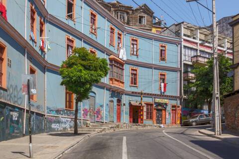
Situated on a number of steep hills, Valparaiso’s kaleidoscope of graffiti and murals are a sight to behold. Perfect for keen walkers.
View prices as:
Your current viewing preference is:
Per-Person Pricing
* Prices shown are per person, based on two adults sharing a twin cabin and include all cruise offer discounts and savings.

LOADING
| Deck | Price | Enquire | |
| DV | Deck 5 | Enquire now |
| Deck | Price | Enquire | |
| G1 | Deck 7 | Enquire now |
| Deck | Price | Enquire | |
| G2 | Deck 4 | Enquire now |
| Deck | Price | Enquire | |
| O1 | Deck 7 | Enquire now |
| Deck | Price | Enquire | |
| O2 | Deck 4 | Enquire now |
| Deck | Price | Enquire | |
| R1 | Deck 6 | Enquire now |
| Deck | Price | Enquire | |
| R2 | Deck 4 | Enquire now |
| Deck | Price | Enquire | |
| SL | Deck 6 | Enquire now |
| Deck | Price | Enquire | |
| VI | Deck 4 | Enquire now |
| Deck | Price | Enquire | |
| VR | Deck 5 | Enquire now |
| Deck | Price | Enquire | |
| ME | Deck 5 | Enquire now |
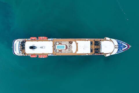
Silver Cloud is a distinctive, ultra-luxury expedition ship. With generously-sized suites, destination itineraries and exemplary service, you are guaranteed a truly unique and spectacular adventure.
What’s onboard: Boutique, Changing Room, Connoisseur’s Corner, Dolce Vita, Expedition Office, Explorer Lounge, Fitness Centre, Guest Relations, Jogging Track, La Dame, La Terrazza, Laundrette, Library, Lobby, Medical Center, Observation Lounge, Panorama Lounge, Photo Studio, Pool, Pool Bar, Reception, The Bridge, The Grill, The Restaurant, Zagara Beauty Spa and much, much more.

Yes, all Silversea ships are equipped to offer Wi-Fi access.
At Silversea, the comfort, enjoyment and safety of all guests is paramount. Most areas onboard are non-smoking and, as a safety precaution, smoking is not permitted in guest accommodations. However, smoking is permitted in the Connoisseur’s Corner and in specifically designated areas.
Yes, guests can take alcohol on their Silversea cruise. There are no limitations.
Gratuities are included in the price of your Silversea cruise.
The currency used onboard Silversea is US Dollars.
Shipboard attire ranges from casual to formal. Casual wear is appropriate for daytime aboard the ship or ashore and consists of standard sports outfits as worn at 5-star resorts. Evening attire falls into 3 categories; casual, informal and formal.
Shore excursions are available to book in advance via My Silversea until 2 days prior to sailing.
Regency Hamper is one per booking, for Ocean View Staterooms & above on cruises of 7 nights & above, for Mainland UK addresses only.